Israel apologizes after Indians protest
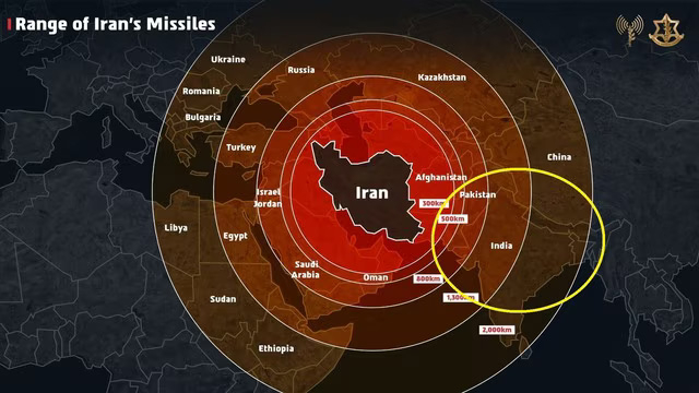
Tel Aviv (Israel) – The Israeli Defence Forces (IDF) have issued an apology to India after a map circulated on the social media platform ‘X’ sparked outrage. The map, intended to illustrate Israel’s missile strike capabilities against Iran, inaccurately depicted Jammu and Kashmir as part of Pakistan and Arunachal Pradesh as part of China.This misrepresentation triggered widespread protests on Indian social media, prompting the IDF to respond.
Iran is a global threat.
Israel is not the end goal, it’s only the beginning. We had no other choice but to act. pic.twitter.com/PDEaaixA3c
— Israel Defense Forces (@IDF) June 13, 2025
The Israeli Defence Forces clarified that the map was merely a symbolic representation of the region and not intended as an official political statement. “We did not display any country or regional borders officially,” the IDF stated. However, they expressed regret to those offended by the depiction.
🚨Israel Shows Distorted Map of India: Kashmir placed in Pakistan, Arunachal Pradesh shown in China!
Israel issues apology after backlash from Indians
India has never taken strict action against any country for distorting its map. That is precisely why anyone gets up and… pic.twitter.com/A2sXgIJ3mT
— Sanatan Prabhat (@SanatanPrabhat) June 14, 2025
inti(The apology from Israel came in cautious terms, expressing regret “if feelings were hurt,” a tone some see as insufficient. Indian authorities are urged to communicate firmly that such inaccuracies are unacceptable. – Editor)
(There is no intention to hurt anyone’s national sentiments behind publishing the above images. These images are published for informational purposes. – Editor)
Editorial PerspectiveIndia has rarely taken firm diplomatic or legal action against countries or organizations that misrepresent its territorial boundaries. This leniency has, over time, emboldened others to casually distort India’s map, undermining the nation’s sovereignty and national sentiment. The government needs to change this image ! |
 Ukraine launches drone attacks on 20 Russian vessels !
 Christian stabs Indian-origin Muslim over his religion in the US
 Pakistani Army opens fire on protesters in Pakistan-occupied Kashmir: 12 killed, 38 injured
 US to impose 100% tariffs on five countries, including India, for purchasing Russian oil !
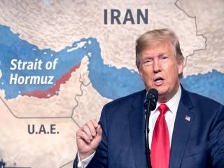 Trump withdraws 20% levy on vessels passing through the Strait of Hormuz
 Porous Borders, Shadow Operatives: Unpacking the Geopolitical Rift in the US-India Intelligence Relations