Images released by ISRO satellite
![]()
Joshimath (UP) – Images released by Indian Space Research Organisation (ISRO) showed that Joshimath had sank 5.4cm in 12 days. The National Remote Sensing Centre (NRSC) of ISRO has released satellite images of Joshimath, Uttarakhand and a preliminary report on land subsidence which estimated that the entire Joshimath may sink.
Analysis of satellite imagery from Indian and foreign sources has revealed that the extent of 'sinkage' at the #Joshimath town in India's Uttarakhand was a total of 14 cm, over a total time period of 9 months
(Report by @sdhrthmp)https://t.co/pWtgcUjLbZ
— WION (@WIONews) January 13, 2023
According to the report, land subsidence was slow between April to November 2022, during which the town had sunk by 8.9 cm. But between 27th December 2022, and 8th January 2023, the intensity of land subsidence increased at a rapid pace, and the town sank by 5.4 cm in just 12 days.
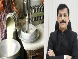 Adulteration in milk and dairy products will be dealt with on a priority basis!
 Benches, bricks and decorative items to be made from the POP recovered from immersed Lord Ganesha idols!
 Bedsheet bearing a ‘Made in Pakistan’ label sold at the Fair near Shri Moraya Gosavi Temple in Chinchwad (Pune)!
 Hindu Police Inspector commits suicide due to religious harassment by a Muslim officer at Budaun, UP
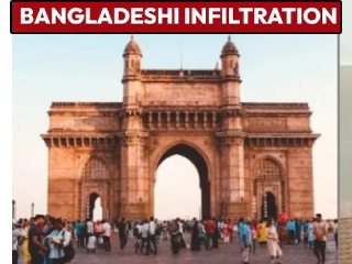 Mumbai has become a hub of Bangladeshi Infiltrators; More than 1500 Hideouts of Infiltrators!
 ‘Devasthan Inam Abolition Draft Act 2026’ put on hold